|
|
|
|
|
Strategic Objective Shapes
Strategic Objectives are broad statements from land and resource management and fire management plans that identify changes in water, soil, air, or vegetation from the present to proposed conditions, but can also describe an existing resource condition that should be maintained. These objectives deal with large areas (the spatial component) over long time periods and project intended outcomes of management activities that contribute to the maintenance or achievement of desired conditions.
Spatial Fire Planning (SFP) requires both the textual and spatial components of Strategic Objectives. Users assigned the role of Data Manager are responsible for locating this information in NEPA-approved planning documents and entering it correctly into WFDSS. The textual and spatial content loaded into WFDSS must accurately represent planning direction for an administrative unit and is used to support incident decision-making.
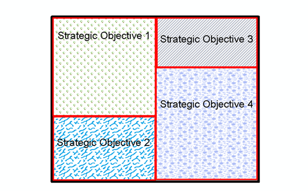
Figure 1: Examples of Strategic Objectives Shapes
The intent of the Strategic Objective shape layer is to allow users to utilize shapes other than FMUs to visually depict an administrative unit’s fire management direction. Although these shapes are called "Strategic Objectives", they can represent one or many of the following terms:
- Administrative Unit boundary
- FMUs
- Fire Workload Areas
- Management Areas
- Management Prescription Categories
Data Managers manage Strategic Objective shapes just like they have managed FMU shapes in the past. Data Managers submit their administrative unit’s spatial data to their WFDSS Data Team Contact. The WFDSS Data Team Contact ensures the spatial data is enabled in WFDSS. The Strategic Objective shapes are then used to build a unit outline shape for each administrative unit.
Each Strategic Objective shape is associated with one or more sets of Strategic Objective text that are entered on the Data Management tab. The WFDSS application supplies a list of common objectives that help Data Managers quickly associate objectives to the shape, or they can create new objectives and associate them with the shape. If Strategic Objective shapes overlap, Data Managers received a message asking how to clip the shape; overlapping strategic objectives is not permitted.
Strategic Objective Examples for use with SFP
Language from each administrative unit’s Land, Resource, and/or Fire Management Plans varies. Most administrative units find that the direction from their Plans likely fits into one or more of these categories:
- Suppress fires at smallest size
- Suppress fires considering cost and or values at risk
- Manage fires for resource objectives
- Preplanned decision to monitor all fires for protection or restoration.
For the examples above, each line would apply to an area on the landscape that would be represented in the spatial data. These are examples only; administrative units that choose to use the new SFP process can use their own exact language for their Strategic Objectives. The following additional examples illustrate that administrative units will likely have several categories of Strategic Objectives within their Land, Resource, and/or Fire Management Plans:
- Manage 60% of natural starts for resource objectives.
- Contain 90% of all unwanted wildland fires at less than 10 acres in size within 2 operational periods.
- Manage fires for resource objectives when conditions and fire start location warrant.
Managing Strategic Objective Shapes
Strategic Objective shapes are not managed locally, but on a national basis. Data Managers submit spatial data to their agency’s WFDSS Data Team Contact, who then ensures the data is enabled in WFDSS. The spatial data is added to the collective National FMU layer, which contains all the FMU and Strategic Objective shapes submitted by agencies to guide incident management and decision-making. The WFDSS Data Team Contact adds spatial data to the National FMU layer on a quarterly schedule, or more often if needed (uploads are done in batches). As a result, it could take a couple of months for Strategic Objectives to be enabled in WFDSS. During this time, Data Managers can add Strategic Objective text, or edit text for Strategic Objectives that have not been activated.
FMU planning does not require spatial data, but with Spatial Fire Planning (SFP), the Strategic Objective shape layer is required and its coverage determines an administrative unit’s boundary. Subsequent shape uploads, such as Management Requirements or Other Unit Shapes, are clipped to it to eliminate overlapping edges and incidents where the shapes fall outside the administrative unit boundary.
In This Section |
See Also |
Reference |